
Hello again. In the previous lesson, you learned to identify the main geographic idea in a statement using the five themes: Location, Place, Movement, Region, and Human-Environment Interaction. Maps are one of the main tools geographers use to show that information visually.
This lesson focuses on reading a map accurately. By the end, you should be able to use a map’s title, legend, symbols, scale, compass rose, and cardinal directions to explain what the map shows and answer common map-reading questions. You will also add concise flashcards to your study set.
A map is a visual argument, not just a picture
A map reduces a real place to a manageable size and selects information for a purpose. Because it cannot show every tree, street sign, building, or person, it uses labels, colors, lines, and icons as shortcuts.
Before answering any question about a map, get into the habit of checking six features:
- Title: What is this map about?
- Legend or key: What do the symbols and colors mean on this map?
- Symbols: What real features do the map’s visual marks represent?
- Scale: How does a map distance compare with real-world distance?
- Compass rose or north arrow: Which way is north?
- Cardinal directions: Where are north, south, east, and west relative to the feature you start from?
The title gives you the big idea first. A map titled Population Density of Canada is not primarily showing landforms, even if rivers and borders appear on it. Those may be background information; the map’s purpose is to show where population is more or less concentrated.
Read the following short section from National Geographic Education to connect these features to their formal map-reading vocabulary.
Map - National Geographic Education
Read National Geographic Education’s “Map” resource for a concise explanation of scale, orientation, title, and legend. It also introduces a useful acronym for remembering common map elements.
First, in the “Scale” section, read the scale explanation through the discussion of bar scales and representative fractions. Focus on the central idea that map distances represent real distances in a consistent proportion. Then find the “D.O.G.T.A.I.L.S” section. Read the orientation through legend entries. Pay special attention to the entries for Orientation, Scale, Title, and Legend; the other entries are useful context but are not the main focus of this lesson.
Title, legend, and symbols: decoding what the map is saying
A title tells you the map’s subject, place, and often its time period. It helps you decide what details matter most.
For example:
- Major Rivers of South America tells you to focus on rivers.
- Average Annual Rainfall in Australia tells you that colors or patterns probably represent rainfall amounts.
- Civil War Battle Sites, 1861–1865 tells you the map is historical, so the date range matters.
Next, locate the legend, also called a key. The legend decodes the map’s symbols. A symbol is a visual mark that stands for something in the real world.
Symbols can represent different kinds of geographic features:
| Symbol type | What it may show | Example |
|---|---|---|
| Point symbol | One specific location | A dot for a city or star for a capital |
| Line symbol | A route, boundary, or flowing feature | A road, railroad, river, or border |
| Area color or pattern | A larger zone or category | Green for forest, shading for climate zones |
| Picture symbol | A feature shown with a small icon | An airplane for an airport or tent for a campground |
Do not assume that a color or icon always has one universal meaning. Blue often represents water, but a blue line could represent a river, a border, or a transit route depending on the map. The legend is the final authority.
Watch this brief explanation before moving on to direction and distance.
Map Key | Definition, Symbols & Examples
Watch “Map Key | Definition, Symbols & Examples” by Tutors for a quick visual explanation of why legends matter and how a compass rose works.
Watch key and symbols to see how a map key helps decode icons and colors. Then watch the compass rose, focusing on its role in showing north and the main directions.
A useful test-taking habit is to write or say the evidence you used:
The dark green area is forest because the legend identifies dark green shading as forest.
That explanation is stronger than simply saying, “It is forest.”
Orientation: compass roses and cardinal directions
A compass rose shows orientation: the directions on the map. The four cardinal directions are:
- North
- East
- South
- West
Most printed maps place north at the top, east on the right, south at the bottom, and west on the left. However, this is a convention, not a guarantee. A map can be rotated. When a compass rose or north arrow is present, trust it rather than assuming the top of the page is north.
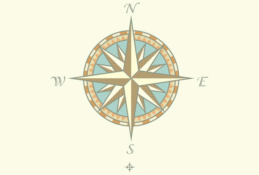
To find the direction from one place to another, begin at the starting location, then look toward the destination.
- If the destination is above the starting location, it is north.
- If it is to the right, it is east.
- If it is below, it is south.
- If it is to the left, it is west.
Some maps also use intermediate directions, which fall between the four cardinal directions:
| Intermediate direction | Position on a north-up map |
|---|---|
| Northeast | Up and right |
| Southeast | Down and right |
| Southwest | Down and left |
| Northwest | Up and left |
Suppose a school is near the center of a north-up map and a hospital appears to its upper right. The hospital is northeast of the school. But if a question asks only for cardinal directions, it may expect the broader answer north and east, or it may be designed so the destination lies directly north, south, east, or west.
Direction questions depend on order. “What direction is the hospital from the school?” is not the same as “What direction is the school from the hospital?” Reversing the starting point reverses the direction.
Scale: turning map measurements into real distances
A scale shows the relationship between distance on the map and distance in the real world. Since maps are smaller than the places they represent, scale lets you estimate or calculate actual distance.
Maps commonly show scale in three forms.
| Scale form | Example | How to read it |
|---|---|---|
| Statement scale | “1 cm equals 2 km” | Each centimeter measured on the map represents 2 kilometers on the ground. |
| Bar scale or line scale | A ruler-like bar labeled 0, 1, 2, 3 km | Match a map distance to the bar to estimate real distance. |
| Representative fraction | One unit on the map represents 50,000 of the same unit in reality. |
Using a statement scale
Imagine a map says 1 cm equals 2 km. If two towns are 3.5 cm apart on the map, multiply:
The towns are 7 km apart in a straight line.
Using a bar scale
A bar scale is especially useful because you can compare it directly with a ruler, a strip of paper, or even the edge of a piece of string.
For a straight distance:
- Measure the distance between the two places with a ruler.
- Place that measurement against the bar scale.
- Read the real-world distance shown by the bar.
For a curved road or river, use a piece of string. Lay the string along the route, carefully following each bend. Then straighten the string and compare its length with the bar scale.
Using a representative fraction
A representative fraction has no fixed unit. The same unit must be used on both sides.
For a scale of :
- 1 cm on the map represents 25,000 cm in real life.
- Since 100,000 cm equals 1 km, 25,000 cm equals 0.25 km.
If two points are 4 cm apart on that map:
So the points are 1 km apart.
The scale video below demonstrates these methods, including measuring a curved route.
Y11-12 Geography: Scale and Distance on Maps
Watch “Y11-12 Geography: Scale and Distance on Maps” by Atomi to see map scales interpreted and used in distance calculations.
Watch types of scale for ratio, statement, and line scales, including the difference between large-scale and small-scale maps. Then watch distance measurement for the ruler method, the string method for curved routes, and the unit conversion process.
A final vocabulary point: large-scale maps show a smaller area in greater detail, such as a neighborhood map. Small-scale maps show a much larger area with less detail, such as a world map. The names describe the size of the fraction, not the amount of land shown.
Reading a map systematically
When you see an unfamiliar map in class or on a test, use this routine:
- Read the title. Identify the topic, area, and date if one is given.
- Check the legend. Decode colors, lines, patterns, and icons before interpreting them.
- Find the scale. Decide whether the question requires a rough estimate or a calculation.
- Find north. Look for a compass rose or north arrow.
- Trace from the starting place to the destination. State the direction carefully.
- Support your answer with map evidence. Refer to the title, legend, scale, or orientation feature that proves your conclusion.
Consider this written map description:
The title is Outdoor Features of Pine Valley Park. The legend shows a blue line for a river, a brown dashed line for a hiking trail, and a tent icon for a campground. A north arrow points toward the upper edge of the map. The campground is to the left of the river, and the trail travels from the campground toward the lower-right corner.
A careful interpretation would say:
- The map shows outdoor features in Pine Valley Park, based on the title.
- The blue line represents a river, based on the legend.
- The campground lies west of the river because west is left when north is up.
- The trail initially heads generally southeast, since it goes down and right from the campground.
Notice that each conclusion comes from a specific map feature. This is the difference between guessing and interpreting.
Flashcards for map reading
Add these cards to the set you made in the previous lesson. Keep the front short. On the back, include the definition and the key action you should take when you see that feature on a map.
| Card front | Card back |
|---|---|
| What does a map title tell you? | The map’s topic or purpose. It often tells the place, subject, and sometimes the time period shown. |
| Map legend | A guide that explains the map’s symbols, colors, lines, and patterns. A legend is also called a key. |
| Why should you check the legend? | Symbols can mean different things on different maps. The legend gives the correct meaning for that particular map. |
| Map symbol | A visual mark representing a real feature or idea. Symbols may be points, lines, colors, patterns, or icons. |
| Point symbol | A symbol for one specific location, such as a city, capital, airport, or school. |
| Line symbol | A symbol for a route, border, or long feature, such as a road, river, railroad, or boundary. |
| Area color or pattern | A symbol showing a category across an area, such as forest, rainfall level, climate zone, or population density. |
| Map scale | Shows the relationship between map distance and real-world distance. |
| Bar scale | A ruler-like graphic that shows real distance. Compare a measured map distance with the bar. |
| Representative fraction | A ratio such as . One map unit equals 50,000 of the same unit in real life. |
| Large-scale map | Shows a smaller area with more detail. Example: a city or neighborhood map. |
| Small-scale map | Shows a larger area with less detail. Example: a world or continent map. |
| Compass rose | A map feature that shows direction and orientation, especially north. |
| Four cardinal directions | North, East, South, West. |
| How do you find direction from one place to another? | Start at the first place, locate the destination, then use the compass rose. |
| If north is up, what direction is right? | East. |
| If north is up, what direction is left? | West. |
| Intermediate directions | Northeast, southeast, southwest, northwest. They fall between cardinal directions. |
| Best map-answer format | Answer, because [map evidence]. Example: “The river is east of the park because it is to the right of the park on a north-up map.” |
For a quick review routine, choose any map from class notes or a textbook and narrate the six-feature sequence aloud: title, legend, symbols, scale, orientation, then direction. Afterward, review the flashcards in mixed order so you practice distinguishing the legend from the title and the compass rose from the scale.
You can now interpret a map by first identifying its purpose with the title, decoding information through the legend and symbols, estimating or calculating distance with the scale, and locating features with the compass rose and cardinal directions. Most map questions become much easier when you use those features in a consistent order and explain the evidence for your answer.
Next, you will move from local map reading to Earth’s global grid: latitude, longitude, the Equator, the Prime Meridian, and hemispheres.
Can't find a good explanation? Sign up and we'll make it for you
Sign up